
Sometimes, I use affiliate/sponsored links with my recommendations, which if bought through might earn me a few pennies at absolutely no extra cost to you. This helps with the cost of keeping this site alive so I can continue to guide you on your travels. Please remember that I would never ever ever recommend anything I don’t or wouldn’t use myself. Big thanks to each and every one of you who have trusted my recommendations so far! Lozzy x
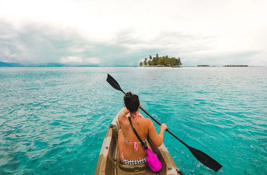
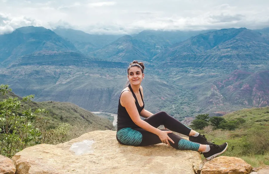
It’s difficult to get by without hiking Colombia at some point – mass tourism is still a fairly new phenomenon so beautiful vistas and landmarks have yet to be ruined by car parks full of tour buses. Therefore, if you want to see the most stunning views in the country, best get on your walking boots!
Hiking Colombia can be incredibly rewarding, especially the times when you get to enjoy the landscape all by yourself (it’s hard to explain the feeling of walking up to something as uniquely incredible as Quebrada Las Gachas and realising there is no one else there but you).
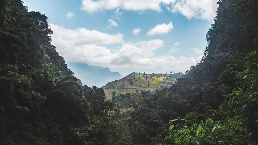
With much of the country being in the Andes, there are always mountains to climb and canyons to marvel at, but towards the edges of Colombia, you can find rainforests to amble through and even deserts to traverse.
After this post on the most epic trails for hiking Colombia, you’ll also enjoy:
- The Ultimate Colombia bucketlist: 29 places to go
- San Gil, the adrenaline capital of Colombia
- Hiking Colombia’s Valle de Cocora
- Cost of living and travel in Colombia
Now, anyone who has been following this travel blog for a while will know that I’m not actually a huge fan of hiking – quite the opposite, actually.
I tend to do the basics but a 2-day trek up a volcano is never going to be on the cards for me, even if you get to see volcano eruptions in the distance at sunrise (sorry, Acatenango, you looked really cool and all, but not for me, hun).
So, to put together a list of all the best trails for hiking Colombia, I’ve called on some fellow travellers to join in a collaboration. What you read below is a mix of experiences of mine and theirs. Hope you enjoy this style of blog post, as it’s my first of this kind!
I’ll be splitting these 11 routes for hiking Colombia into easy, moderate and difficult. I trust you know which group you fit into! And right at the end of this post, I’ll give you a nice visual grid of the kinds of things you should be grabbing to prep for your adventures. As you embark on hiking Colombia, remember to use the Leave No Trace rule, so things are left exactly as you found them.
Want to skip to something in particular?
Hiking Colombia’s easier trails
1. Parque Tayrona
Nearest major town: Santa Marta
Time needed to enjoy this hike: a full day
Trail time: 2-3 hours each way
Shared by Bailey from Destinationless Travel
One of the easiest and most beautiful trails for hiking Colombia is in Tayrona National Park. This pristine park offers the chance to walk through the wild jungle stopping at beaches along the way.
Although there are several different hikes within Tayrona National Park, the most popular trail is from El Zaino entrance gates to Cabo San Juan beach and accommodation. This trail is fairly easy and takes most people about 2-3 hours to complete it one-way.
Along the way, you’ll pass various viewpoints looking out over the ocean and jungle. You’ll also have the opportunity to spot wildlife and I actually saw a few monkeys when I was there!
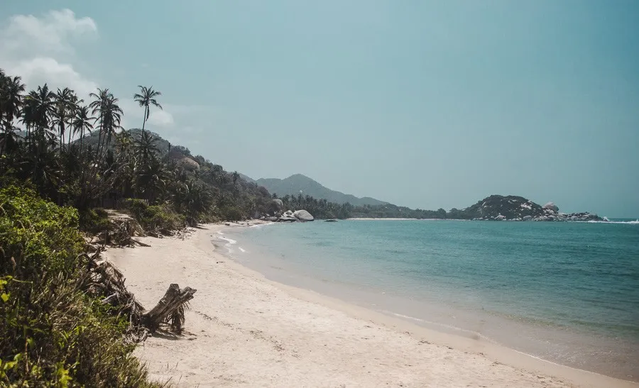
The best part about this hike is that you can stop at various beaches along the way and cool off with a swim! Each beach is signposted and will let you know if swimming is permitted or not. My personal favourite beach along this trail is called La Piscina (or “the pool”.) This beach bay has very calm water, you can just relax in the water as if it were a pool!
You can choose to do this hike on a day trip from Santa Marta city, or stay the night within the park.
There are actually a few different places to stay in Tayrona National Park, with my favourite being Cabo San Juan Beach. Walk from the entrance gates to Cabo San Juan where you can spend the night in a cabin, tent, or hammock before returning back to the entrance the next day. This makes for an epic 2-day adventure of hiking, swimming, and camping in one of the most beautiful destinations in all of Colombia!
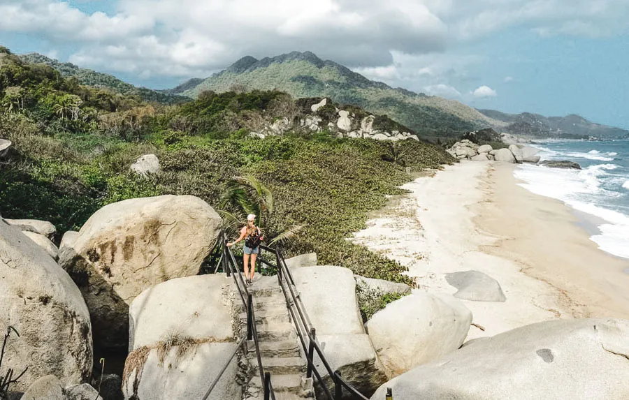 It is important to note that you will have to pay COP$54,400 to enter the national park. If you want to spend the night, you will also have to pay for your accommodation. Also, be sure to bring your passport as this is required to also enter the park.
The hike does not require a guide, but there are plenty of guided tours available if you’d prefer to go with someone who knows the area well.
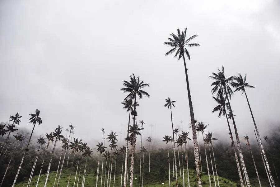
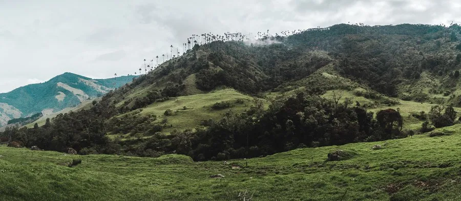
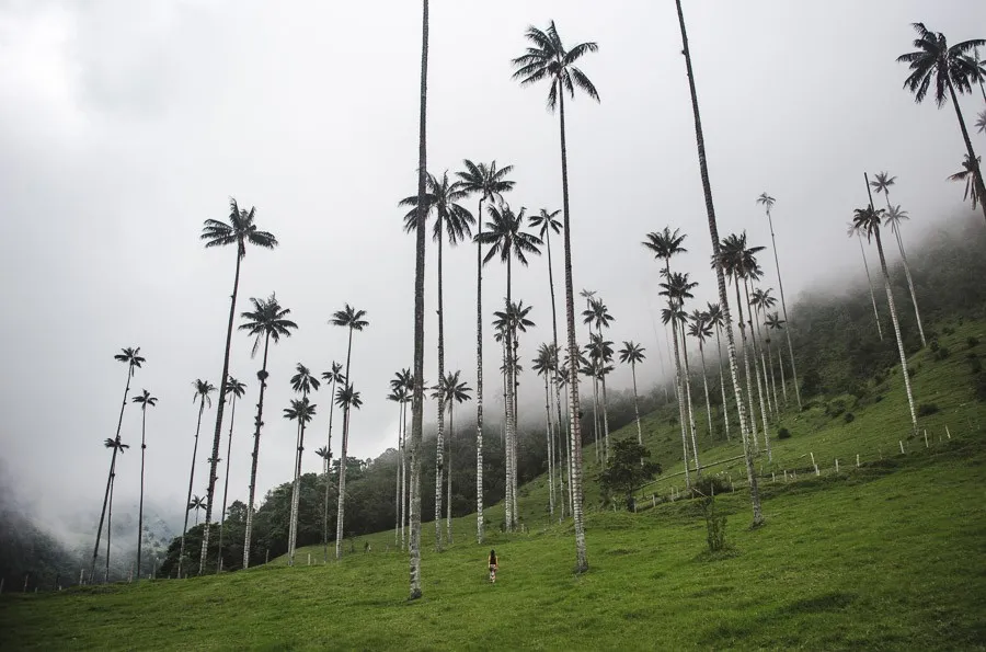
2. Valle de Cocora
Nearest major town: Salento
Time needed to enjoy this hike: 2.5 for the small loop, 5 hours for the full loop
Trail time: 2 or 5 hours
Thanks to being home to the tallest wax palm trees in the world, with some reaching as much as 60m (200ft) high, Valle de Cocora is one of the absolute must-do hikes in Colombia.
Hiking here almost killed off my parents when we trekked the wrong mountain (see how to avoid this mishap in my Cocora Valley guide), but in theory it should only take either 1 or 5 hours, depending on the trail option you take.
The 1-hour trail just takes you to the main viewpoint of the palm trees and back (and for that reason. I’m categorising this as one of the easier hikes in Colombia), whereas the 5-hour loop is an adventure through the Colombian countryside (this is definitely mid-level). This option can be done either clockwise or anti-clockwise.
To do this hike, you’ll first want to get to the nearby town of Salento or its little sister, Filandia, and stay for a few days because it’s a wonderful area with lots to do, such as visiting a coffee farm.
To hike Cocora Valley independently, grab a space on one of the colourful jeeps (called Willies) from the main plaza – it’s recommended to get there as early as possible – and when you get to the entrance, either turn down the path signed for the salmon farm on your right to take the anti-clockwise loop, or continue straight ahead up the dusty road to begin the 1-hour trail or clockwise loop.
You do not need to go with a guide, though you can take a small group tour if you like, or arrange a guided horseback tour prior to going or at the entrance of the park.
The horses on the Cocora Valley hike seem in a lot better condition than elsewhere in South America, but if you’re in doubt about a horse’s health or treatment, it’s never too late to say no. There’s actually a separate Cocora Valley trail for horses, so on-foot hikers won’t have to look out for their mess.
For those with conditions that weaken their knees, the full 5-hour loop is not recommended, as there are uneven, sometimes slippery climbs and descents of up to 800m, plus a few wobbly log bridges to tackle.
What’s nice about the 1-hour hike is that you’re surrounded by the lofty palm trees almost immediately and the trail on the way back is the same one you came in on, so if you at any point feel it’s too much, you can cut your hike short and still feel like you’ve seen what you came for.
The shorter trail also has some new insta-ready instalments, such as a decorative Willy and some giant condor wings to pose next to.
When hiking Colombia’s most popular trail, you’ll want to bring a bit of spare change for the Willy ride (4k COP) and the park entry fee (3k) plus an additional fee for entry to the 5-hour loop (4k). Note that it’s entirely possible that some of these prices might change post-pandemic in order to scrape back some losses.
You’ll also want a lot of water – I highly recommend getting a Chilly’s bottle which can keep your water icy cold for up to 24 hours – and some cushioned hiking socks to soften the impact on your heels.
Despite being below literally hundreds of palm trees, most of the trails are out of the shade, so bring a hat and sunscreen.
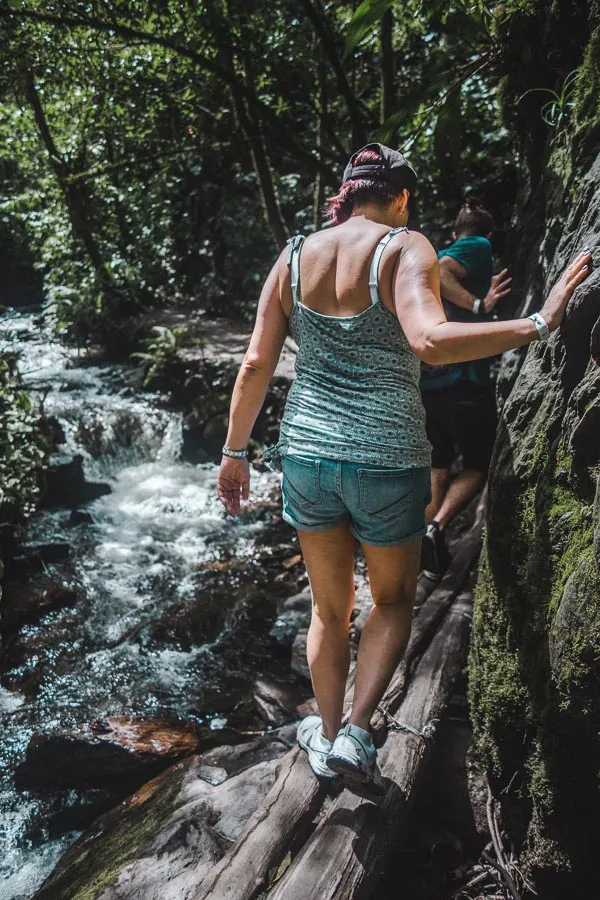
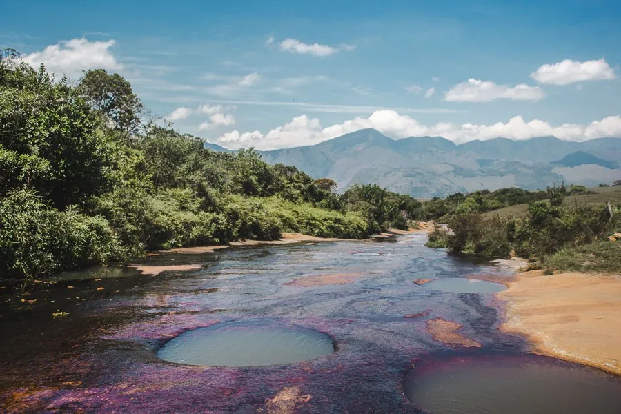
3. Sendero Las Gachas
Nearest major town: Guadalupe
Time needed to enjoy this hike: 3 hours
Trail time: 1 hour each way
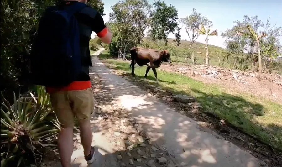
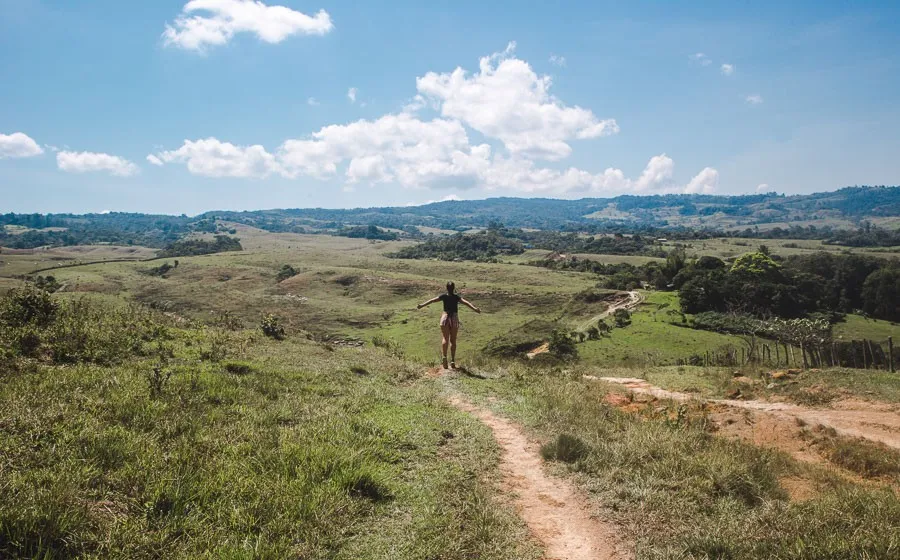
Possibly the most intriguing of all the areas for hiking Colombia. The trail from the small pueblo of Guadalupe to the natural plunge pools of Quebrada Las Gachas is a shadeless amble through suburbia, up one of the steepest hills in all the land and then into the grassiness of open farmlands.
Though the hill does feel rather never-ending at the time, you’ll have waving campesinos and livestock to greet, and cray-cray views over the hills. This is a little trip into true Colombian life.
The Sendero Las Gachas takes around an hour from the central plaza of Guadalupe, and around a third of the trail is just an easy and fascinating walk through the outskirts of the town. A guide is not needed for this Colombian hike.
You’ll definitely want to take something to protect you from the sun (any sunscreen should be biodegradable so as not to disturb the algae), and plenty of water.
The last chance you have to buy anything is at the petrol station just before the trail turns off the main road and up an understated path to the right. Make sure you’ve stocked up, as you’re going to be in the beaming sun for a long time when hiking Colombia’s Santander department!
When you arrive at Quebrada Las Gachas, the first thing you’re going to want to do is plunge yourself into one of the many pools that have formed in the purple riverbed – and you can, as there is no entrance fee for this natural wonder. However, don’t pick the first holes to dip into; the better ones are all a 5-minute walk upstream. These pools are up to 6ft deep, and the walls of them are almost entirely vertical.
The river is turned pink and purple by year-round algae, which shows more vibrantly when wet.
It’s imperative that you keep your socks on when you walk on the riverbed; this is because the algae makes it dangerously slippery, and there aren’t many options for medical transport should you fall badly on the rock. I’d recommend bringing some non-slip socks with you.
Obviously, don’t forget to bring some swimwear too, and a microfibre towel to dry off quickly before hiking back to Guadalupe.
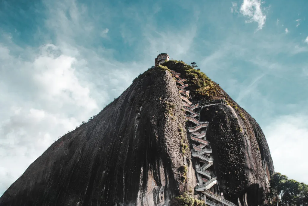
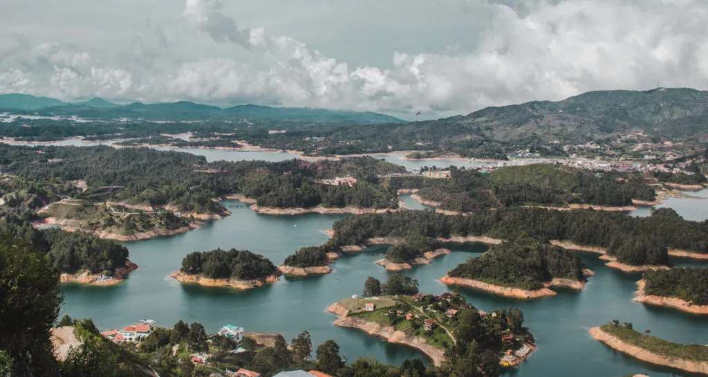
4. El Peñol de Guatapé
Nearest major town: Guatapé, near Medellín
Time needed to enjoy this hike: 1.5 hours
Trail time: 20 minutes up, 10 minutes down
Shared by Taylor from Taytrum Travels
The Stone of El Peñol is known as “one of the largest rocks in the world.” While this is less of a hike and more of is more of a steady climb up an endless staircase, it’s worth the mention. Standing at 200 meters (656 feet) from the base, visitors climb roughly 740 steps to reach the very top.
There are several viewing platforms, convenience stores, and souvenirs for sale on top of the rock. It costs about $5 to access the stairs, the only way up.
You don’t need to be particularly fit to climb to the top. It takes about 20 minutes accounting for photos along the way. Nonetheless, practical footwear is recommended as the steps are made of stone and the area immediately around the rock is dirt and gravel.
You can visit El Peñol from the nearest towns of Guatapé or El Peñol. It is also an easy day trip from Medellin, located about 2 hours away. Guatapé is particularly popular with tourists because of its colourfully-painted town, making a combination trip to the rock and Guatapé a common day trip from the larger city of Medellin. You can go with a guided group or on your own.
Both the towns of Guatapé and El Peñol have claimed the rock as their own, leading to heated disputes. At one point residents began painting the word of Guatapé onto the northern rockface. However, this was quickly noticed by residents of El Peñol and stopped. As a result, only a G and part of the U made it onto the rock.
In the 1970s the area was dammed, causing the landscape of the area to change dramatically. From the top of the rock you get an impressive 360 degree view of winding bodies of water against the lush green hills.
5. El Camino Real
Nearest major town: Barichara
Time needed to enjoy this hike: 5 hours
Trail time: 2 hours each way
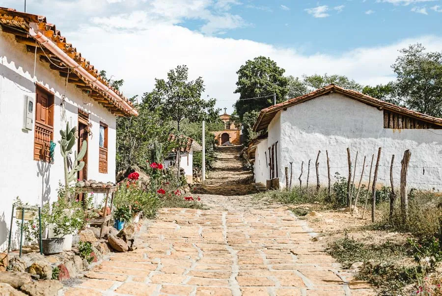
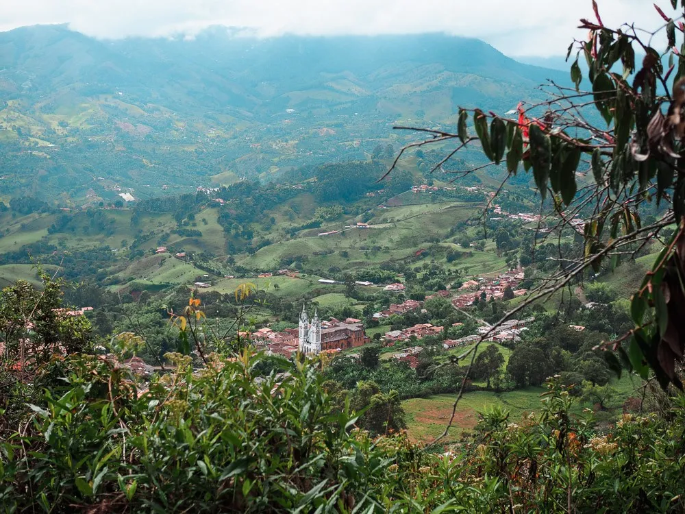
Amongst the simpler trails for hiking Colombia is El Camino Real. High up in the mountains surrounding the Chicamoya Canyon, this hike will take you on an ancient cobbled road from Barichara (said to be the most beautiful pueblo in Colombia) to Guane, which is a teeny uber-authentic town that gets very little limelight (and that’s pretty nice!).
El Camino Real was a route used first by the indigenous Guane people for trade, before being rebuilt by conquistadores and becoming a daily part of the lives of colonial peasants who usually took the path barefoot – not because they didn’t have shoes, but to protect their shoes from the less well-paved parts of the route.
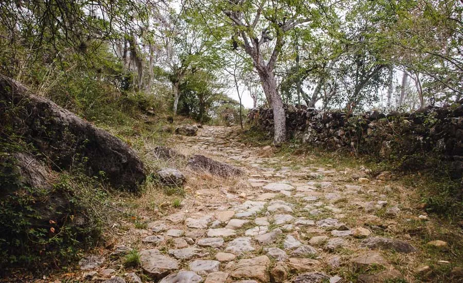
This trail will take you all through the mountains, with some parts smoothly cobbled and others jagged and overgrown. You’ll go past small farms marked by haphazard stone walls and modern highways that snake down the valley.
This is kind of what I expected when I thought about hiking Colombia before going there.
Don’t miss climbing up ‘La Piedra’, which is a huge rock the overlooking the canyon, found by going through a local family’s house (make sure to at least buy a drink from them!).
Though mostly flat/downhill on the way to Guane, you’ll probably work up a bit of sweat as you hike to the village, so make sure you bring plenty of cold water in your Chilly’s bottle. Only as you get close to your destination do you start to see farms that sell water and fizzy drinks.
This Colombia hike is 9km long and takes around 2 hours for someone with average fitness. The route is very straight-forward and you do not need to hire a guide, but there are some private hiking tours available from Bucaramanga if you don’t want to stay in the pueblo, or fancy learning more about the area as you go.
Once you arrive in the pueblito of Guane, make sure you order a goat menú del día in one of the local restaurants. Delishhhhh!
But the best part? After hiking Colombia’s Camino Real, you can always get the public bus back to Barichara for a mere 4,200 COP if you’re feeling too tired to walk back the same trail. Now that’s my kinda hike.
If you’re up for more of an adventure, you can take the waterfall rappelling tour from Barichara which includes a hike back out of the canyon, too.
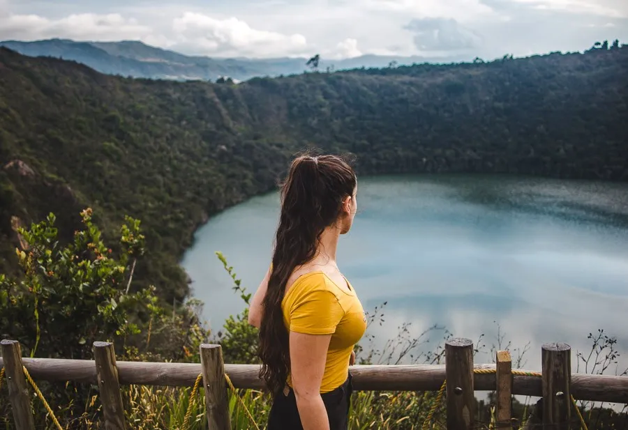
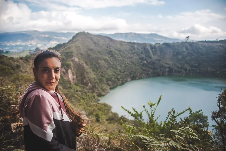
6. Lake Guatavita
Nearest major town: Guatavita (near Bogotá)
Time needed to enjoy this hike: 2 hours
Trail time: 1.5 hours
Not far from the constant barrage of noise that is Bogotá, Guatavita provides a tranquil respite deep in the Cundinamarca countryside. And while the town of Guatavita is quaint, what draws people to this area is the lagoon of the same name that sits in a crater, 7km away.
Lake Guatavita was supposedly the inspiration for the legend of El Dorado, in which the Spaniards caught wind of a large amount of gold being thrown into the lake for a sacred Muisca ritual, and they literally moved a mountain trying to find the treasures (they never did). Nowadays, you can take a fairly easy 90-minute hike around the crater’s edge to see the turquoise waters of the lake.
To do so, you can drive or take a bus from Guatavita town up to the park’s entrance, and then pay for an official Spanish-speaking guide from the tour office at the entrance to the lake’s trail, or organise a private/small group guide who can include transport from Bogotá as well as an English-speaking tour.
What’s most interesting about the tours is learning about the indigenous Muisca culture and history in the area. If you decide to do this little bit of hiking Colombia by yourself, there are English and Spanish signs around the trail that explain the nature around you, but don’t go much into the cultural details.
Hiking Colombia is always full of epic landscapes, and Lake Guatavita is no different. Rolling green hills surround the lake, and the flora is a testament to the wonders of evolution to survive at high altitude.
The best time to go is midday to early afternoon on a clear day, when the higher sun gives the water a more dazzling colour.
This hike is only moderately difficult during the climb to the top of the crater’s edge, but remember that the altitude here is 3000m (10,000ft), so if you’re not yet adjusted to the thinner air of the area, you will feel like you’re struggling to breathe. A few days adjusting to Bogotá’s 2600m altitude will help before hiking Colombia’s loftier parts.
Lots of the path is paved, but there are some uneven steps which can get slippery when it rains.
For this hike, I’d recommend that you wear layered clothing – you’re going to be doing a bit of uphill hiking during this trail, which will make you hot, but the weather at this altitude still has a tendency to be cool, and it gets windy at the top! T
here’s also always the chance of rain at this altitude, so wearing lots of items that can keep you protected from the climate but that you can easily strip off and tuck into your day bag when overheating – like a thin windbreaker – are ideal.
Ooh yeah, girl, werk that windbreaker.
Mid-level hikes in Colombia
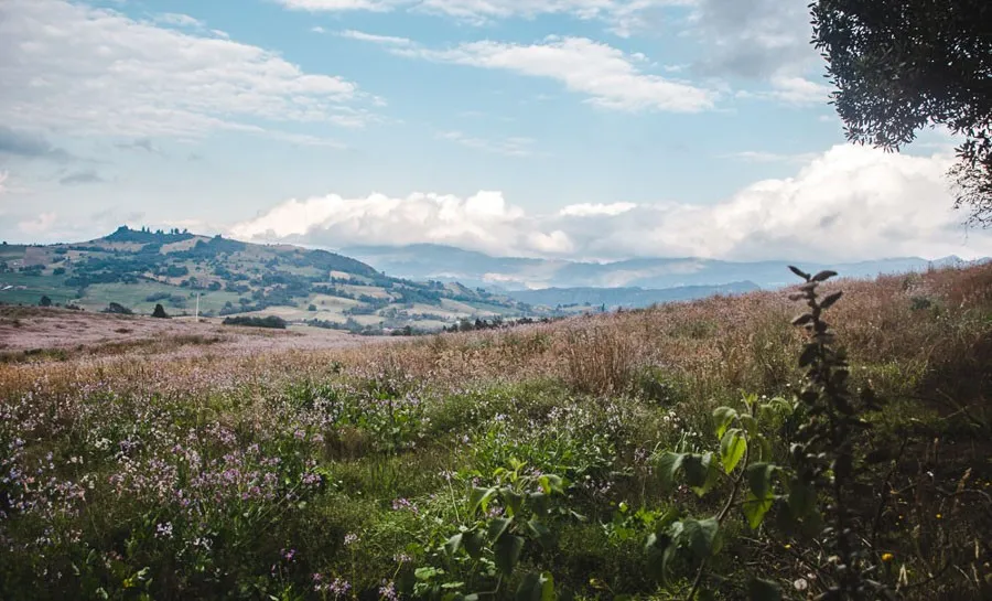
7. Páramo de Ocetá
Nearest major town: Monguí
Time needed to enjoy this hike: 6 hours
Trail time: 3 hours each way
Shared by Megs from Packing Up The Pieces
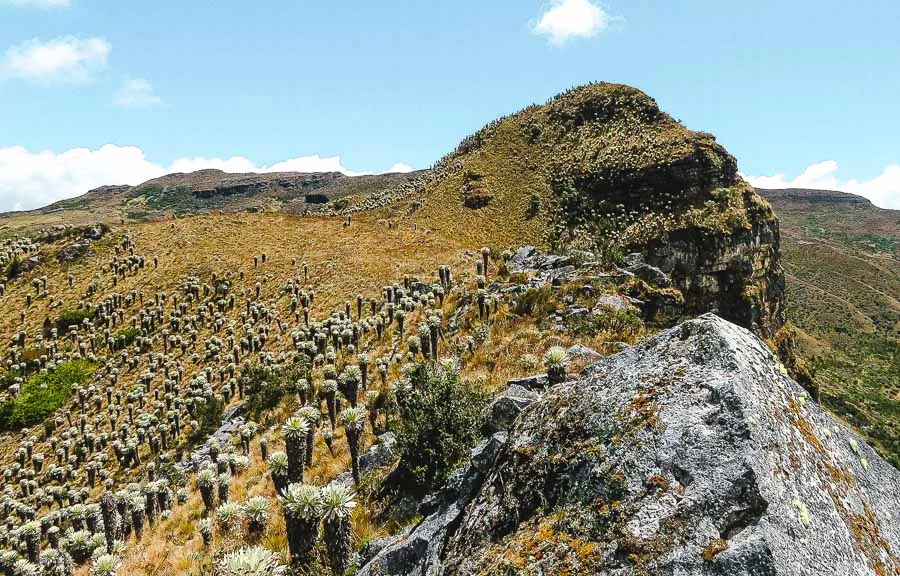
Lying hidden in the little-visited Boyacá region, the epic Páramo de Ocetá is an almost untouched slice of hiking Colombia. Páramos are found throughout the northern Andes Mountains, and can be summed up as unique biospheres at high elevations, over 3,000 meters.
The hike up to Páramo de Ocetá can be easily accessed from the charming village of Monguí, which is worth a stop in itself.
The summit and best viewpoint of the Páramo can be reached from the trailhead behind the village’s main basilica. There are marked signposts at the start and end of the trailhead, and a few scattered along the way.
In the main Plaza de Armas of Monguí, a few tour agencies offer daily hikes up to the Páramo. It is possible to hike the Páramo de Ocetá without a guide, but the tours are extremely affordable and explain how the bio-system works at such high altitudes.
The guides also share a brief history of the Indigenous people, the Musica, who called this region their home before the Spanish arrived.
In the past few years, there have been land disputes with local farmers, so for those who don’t have lots of experience before Colombia, a tour is advisable. You can even take day tours all the way from Bogotá. Those who wish to hike independently can follow a wide range of trails throughout the Paramó. Download an offline map and check for signage.
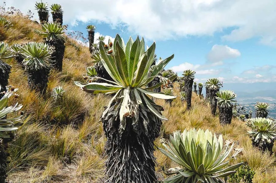
Once at the trailhead, start the steady climb up, pass old sacred sites, and begin to see one of the most prevalent plants that calls the Páramo their home, the giant frailejones. These plants are distant relatives to the sunflower and grow only 1 cm a year. In the Páramo de Ocetá, expect to find some towering in the plateau at over 10 meters, which means that many of them are over 100 years old!
On top of the frailejones, the Páramo is filled with lichen, and if you’re lucky, you may spot a few deer running through the meadows. From the summit viewpoint at 3,900 meters, appreciate the frailejones that seem to cover the mountains.
The summit takes around 3 hours to reach from Monguí.
Due to the high altitude of the Páramos, be mindful of proper acclimation. Move slow, stop for breaks, and take in deep breaths. Breathing may be a challenge. At this altitude, water is scarce, so make sure to bring plenty of water and stay hydrated. Wherever you’re hiking Colombia, it’s best to bring a first-aid kit and wear good hiking shoes with ankle support.
8. Cerro Las Nubes
Nearest major town: Jericó
Time needed to enjoy this hike: 4 hours
Trail time: 1.5-2 hours each way
Shared by Emily from Wander-Lush
Located 100 kilometres southwest of Medellin, Jericó is one of the most charming small towns in Colombia’s Antioquia department. A must-do when visiting Jerico is to hike up to the city’s best viewpoint, the Mirador Parque Natural Las Nubes.
The route, known as the Cerro Las Nubes, is easily one of the best short hikes in Colombia. Even though it’s not perfectly marked, it can still be done independently without a guide.
The hike takes around 3 to 3.5 hours round-trip depending on your pace. It’s recommended to factor in a bit of extra time at the top for photos and for following the smaller trails along the ridge.
While the track itself is rough, the thing that makes this part of hiking Colombia special is the views of the Cauca Valley – famously dubbed the ‘greenest valley in the world’ – and the town of Jericó itself that you get from the top. On a clear day, you can see all the way out to the Pico de la Tusa mountains.
Because of the altitude, the mountain is often shrouded in thick clouds, limiting visibility. But this is part of the magic of hiking Colombia’s Andean region! Oftentimes, you’ll find one side of the valley submerged in a dense fog while the opposite side is crystal clear.
The trail starts from Jericó’s main square and an ascent up 80 concrete steps. From there, you follow Carrera 6 to the stone path, and when you see the wooden bridge, take a left to follow the dirt trail. The terrain is quite steep and uneven in sections so it’s only recommended to do this hike if you have a medium level of fitness and good mobility (coming back down is very hard on the knees).
Because a good portion of the trail is soft dirt, it’s not recommended to try this favourite of Colombia hiking after heavy rainfall. Landslides are common and it can be dangerous when muddy.
Also, be wary of getting lost in the thick brush. There are multiple pathways, but it’s recommended to go back down the way you came. For peace of mind, you can use the marked trail on Wikiloc for navigation.
While it’s particularly nice to be at the top for sunset, you should be very cautious about descending the mountain in the dark. A flashlight and/or headlamp/chestlamp is essential, as are good walking shoes, trekking poles if you use them, plenty of drinking water and snacks.
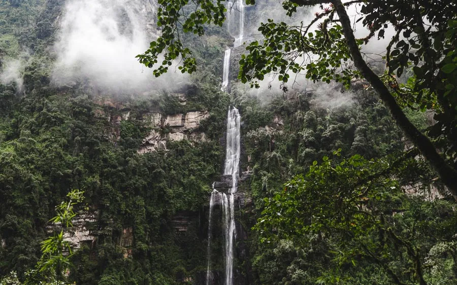
9. La Chorrera
Nearest major town: Choachí (near Bogotá)
Time needed to enjoy this hike: 4 hours
Trail time: 1.5 hours each way
So… Ya like waterfalls? Might you be interested in… Hiking Colombia’s tallest waterfall’s trail? Yes ma’am, just an hour’s drive from Bogotá begins the jagged trail up this 650m beauty. La Chorrera looms over the valleys of Cundinamarca as it cascades down a lush cliff-face.
This hike will take you all the way to the point the water hits the ground; if you go outside rainy season the water spray is light enough to just tickle.
The journey to the start of the hike is an adventure in itself; the surrounding fields and ramshackle houses are a true look into the arduous existence of Andean farmers. There are several legs to this trip, so find out how to get to La Chorrera waterfall hike from Bogotá here.
Then, the trail itself takes you through tight rocky passes, craggy fields, and forest before you reach the waterfall at the end of the road. There are a lot of stairs up and down as you pass over hills and valley paths. My hamstrings were dead for three days.
On the way, you also have the option to stop at a smaller waterfall, which you can walk behind or rappel down, and also opt for a separate trail through the forest called the ‘Monkey Cave’. There are no actual monkeys, but it provides a cool new viewpoint of La Chorrera.
Without spending long at these stop-offs, the hike takes around 90 minutes each way. Make sure you’re back before dark as there are no artificial lights out in this corner of the Colombian countryside!
If you want to see La Chorrera at its most voluptuous, rainy season is the time to go, but be warned that the path is much more difficult when wet. Rainy season in Colombia occurs in the months of April, May, October and November. Most of the hike’s path is mud, so slips might occur if you don’t have decent grip on your shoes.
During dry season, hiking Colombia’s tallest waterfall trail is much easier, but you play off the epicness of the water stream. I was lucky enough to do this hike in both dry and rainy season, and I’d say it’s still magical either way.
You don’t need a guide for this gem of hiking Colombia (though private tours do exist for an easier experience!), however you do need to register at the tourist office right at the start of the trail. They’ll take your details, play you a preservation video, give you a wristband and ask for a 15k COP entry fee.
You can rent wellies off them if your shoes aren’t up to the challenge. Definitely bring a hooded poncho or windbreaker with you, if the rain doesn’t make you soggy, the mist from the waterfalls will.
After hiking Colombia’s tallest waterfall trail, you must – MUST – stop for a lunch at the Cuban restaurant next to the trail entrance. If push the boat out and order a mojito, the owner with even do a dance for you.
10. Tatacoa Red Desert, near Villavieja
Nearest major town: Villavieja (near Neiva)
Time needed to enjoy this hike: a full day
Trail time: 1-2 hours
Shared by Dan from Layer Culture
When looking for the best options for hiking Colombia, if wanting to do something completely unique, you cannot miss out on the Tatacoa Desert. Located in the Huila department, this amazing extraterrestrial terrain offers you the opportunity to hike in the red desert.
But beware, this place is not for the faint-hearted. You will walk through the blistering heat and need to carry certain provisions such as water and even some snacks so that you arrive at the desert equipped for a full day’s hike.
You’ll find that the area is hot all-year-round but the best time to visit is during the dry season which is from June to August. Tatacoa desert is a great place to visit in Colombia for anyone that wishes to escape the city, get off the beaten track, and be at one with nature.
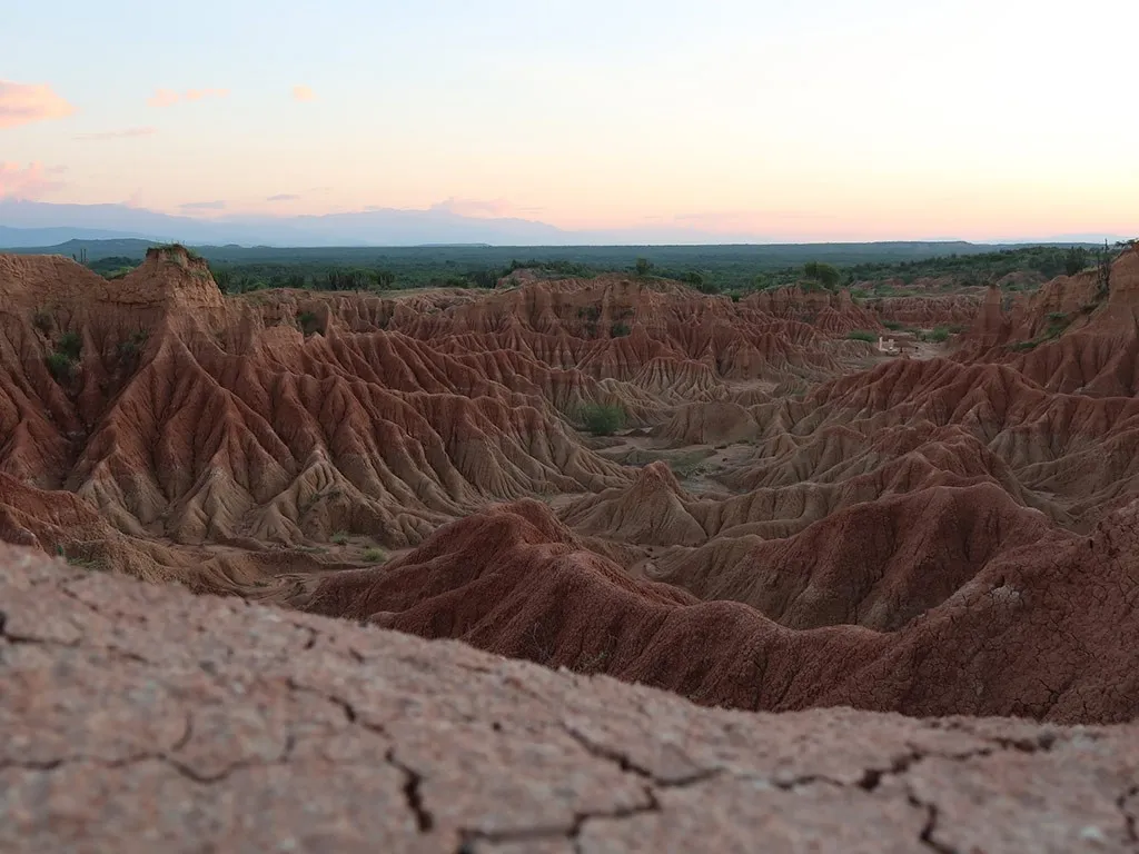
Along this hike, you’ll encounter many different cacti and other living species such as snakes, spiders and scorpions, most of which are completely unique to the area.
Travel from major cities is quite simple but you do have to make various stops. If travelling from Bogotá or Medellín, you’ll need to travel to Villavieja (the nearest village to the desert).
Once you arrive in Villavieja you can take a mototaxi (i.e. motorbike) to the red desert. Also, whilst in Villavieja be sure to pick up your food supplies and enough water to last you the duration of your stay. There are hostels that provide some decent Colombian food but the supply is quite limited.
The red desert is signposted but if you speak/understand Spanish it can be worthwhile to hire a local guide to take you around; that way you’ll get a full explanation of the trails.
All in all, Tatacoa is a must-see and perfect for those who want to get hiking Colombia but fancy a change from the lush green mountain hikes that are popular throughout the rest of the country.

Hiking Colombia for the brave
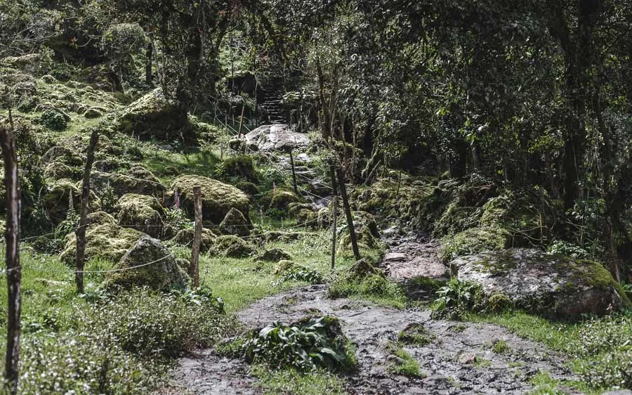
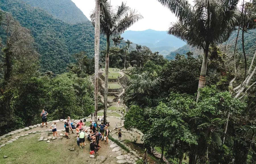
11. La Ciudad Perdida
Nearest major town: Santa Marta or Palomino
Time needed to enjoy this hike: 4 days
Trail time: 4 days!
Shared by Becky from @becksplore
The Lost City (La Ciudad Perdida) is an ancient city and archaeological site in the North of Colombia. The city is located in the Sierra Nevada de Santa Marta mountain range, and can only be reached by foot. This makes the Lost City Trek a popular multi-day hike and a must-do activity when hiking Colombia.
To protect the indigenous tribes and the environment, you are only allowed to stay on one hiking trail, which is why you will take the same route to get to the Lost City and to return back to the starting point.
This hike can only be completed with a certified tour company in a three-day, four-day, or even five-day tour. Most people opt for the 4-day hike. The whole trip can cost you as little as 1,150,000 COP (~350 USD) – prices may change over time.
The starting point of the trek is around a 2-hour car ride away from Santa Marta. But since it is an organised tour, you will be picked up from your accommodation in the morning and then taken to the tour company office to sort out the rest of the payment, and then depart for the trek together once everybody has arrived.
You will start walking early each morning, at night you will sleep at the camps along the hiking trail and you will be provided with 3 meals a day.
During your hiking, Colombia will show you the most beautiful nature and views, and you will also meet some of the indigenous tribes that live in the mountains and learn more about their culture.
Even though you will be hiking Colombia’s forests for four days, try to only bring as little as possible as you will have to carry your luggage throughout the entire duration of the hike. Due to the humidity, your clothes will be wet constantly anyway, so most people just wear the same hiking outfit every day.
Also, make sure to bring sunscreen, some bug repellant, a portable charger, a bathing suit and something waterproof for your valuables just to be sure as you have to cross a river towards the end of the trip.
La Ciudad Perdida is closed in September due to preservation. Besides that, hiking Colombia’s lost city can be done throughout the rest of the year. However, in October and November it will be rainy season, so expect the hike to be a bit more challenging.
Overall, you should have a good level of fitness to complete the hike as it is quite difficult – especially towards the end as you have to climb 1200 steps to make it up the the Lost City. But actually making it to the Lost City is one of the most rewarding experiences you can have when hiking Colombia.
So there’s all you need to set off hiking Colombia! There’s so much diversity and richness of hikes in this country that you’ll always have something to keep your feet busy and your eyes amazed.
Now you’ve reached the end of this post on the most epic trails to experience hiking Colombia, don’t miss out on:
- The Ultimate Colombia bucketlist: 29 places to go
- Hiking Colombia’s Valle de Cocora
- Cost of living and travel in Colombia

Liked this guide to the best trails for hiking Colombia?
Save any image in this post as a pin on Pinterest to be able to easily find again later!
Last Updated on 20 January 2026 by Cuppa to Copa Travels